CLIMATE
CLIMATE is the average weather conditions of a region, or the weather patterns that occur over many years. It is usually described by the average monthly and yearly temperatures and the average amount of PRECIPITATION (rainfall, snow, sleet etc.) To give a true perspective of a region’s climate, several factors must be investigated that affect the temperature and precipitation.
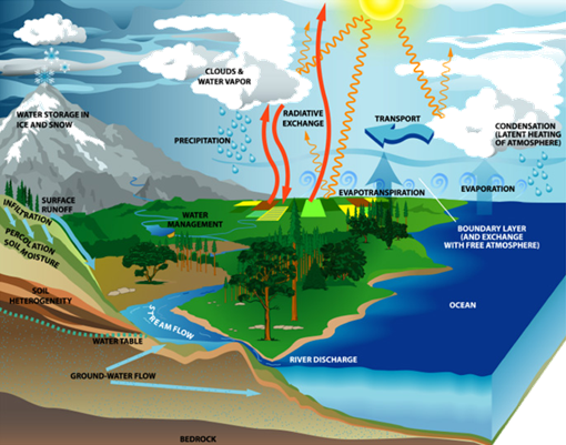
The Earth’s climate system is
made up of a complex number of interacting parts. The prime mover of the system
is the sun, whose energy heats the Earth. This causes circulation within the
air and the oceans and drives the evaporation and precipitation processes of
the water cycle. In addition to the atmosphere and the oceans, the climate
system includes fresh water, plants and animals, ice and snow, land masses and
even the Earth’s crust.
The first factor that affects climate is LATITUDE. This is the distance from the equator. This has a major influence on the climate of a region because it determines the amount of solar energy received by and the prevailing wind patterns of the region. How much solar energy a region receives depends on the angle at which the rays strike the Earth and the number of hours of daylight. At the equator, the sun’s rays always strike the earth at almost a 90 degree angle. In this region, day and night are each about twelve hours long throughout the year. This results in steady high temperatures year-round and a yearly temperature range of only 3 or 4oC in most areas. There are no summers or winters, only dry or rainy seasons.
The farther toward the
The distance a region is from the equator also determines global wind patterns. Winds greatly affect weather conditions of humidity, amount and type of precipitation, temperature and cloud cover. These minor factors have also a great affect on a region’s climate.
The second major factor affecting climate is HEAT ABSORPTION AND RELEASE.
Land and water absorb and release heat at different rates
than water does. Land also cools faster than water does. Water movements like
waves and currents continuously replace warm surface water with cooler water
from the ocean depths. This has a steadying influence on the temperature of the
atmosphere. The ocean stores solar energy in the summer and releases it into
the air in the winter. Ocean currents carry the warmth of tropical waters
towards the
The third major factor affecting climate is TOPOGRAPHY, or the shape of the land. The higher the ALTITUDE or height above sea level the lower the average temperature. So snow can be seen on the tops of mountains that may border desert areas. In fact, those dry desert areas are produced when air passing over a mountain range loses its moisture as it rises and cools.
A weather phenomenon that affects the climate throughout the
world is called El Nino. It is a part of the interaction of the tropical waters
of the
La
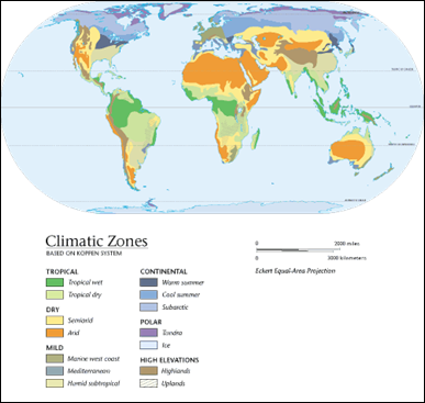
The climate of a particular region has a direct impact on the people who live there. The following videos discuss the difference between weather and climate and identifies the six major climate regions.
![]() What is Climate? (01:18)
What is Climate? (01:18)
![]() Climate Regions (02:06)
Climate Regions (02:06)
![]() Five Factors that Affect Climate (05:23)
Five Factors that Affect Climate (05:23)
![]() Climate Changes (04:05)
Climate Changes (04:05)
![]() How Climate Affects Living Patterns (02:25)
How Climate Affects Living Patterns (02:25)
![]() The Water Cycle (06:05)
The Water Cycle (06:05)