WEATHER AND CLOUDS
Unit Overview
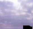
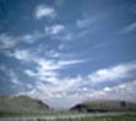
Different types of clouds
give clues about the weather that is coming. Observing clouds can tell us
whether it is likely to rain or snow or if a storm is coming. Weather
satellites read clouds in large areas and help forecasters recognize weather
patterns. If there were no clouds in the sky, the water cycle would be
incomplete. In this unit you will be able to find out the shape of clouds and
what kinds of weather should develop when seeing that cloud. Most people do not
realize that the water you are drinking today was also the same water that a
dinosaur could have drunk.
|
VOCABULARY |
|||
|
weather |
clouds |
cumulus |
stratus |
|
cirrus |
cluster |
storm |
crystals |
|
tornado |
hurricane |
produce |
cumulonimbus |
The twelve vocabulary
words above are throughout this unit.
Be prepared to know what the words mean so that you can understand how
the words are used in the unit. Below are some definitions you can practice
with to help you understand the words better.
Vocabulary
Definitions:
· weather is the state of the atmosphere at a
place and time as regards to temperature, wind, rain
· clouds are visible masses of condensed watery vapor floating
in the atmosphere, usually high above the level of the ground
· storms are violent disturbances of the
atmosphere with strong winds and usually rain, thunder, lightning, or snow
· crystals are clear transparent minerals,
especially quartz
· tornadoes are violent rotating wind storms
having the appearance of a funnel-shaped cloud
· hurricanes are storms with violent winds, in particular a
tropical cyclone in the Caribbean
· produce means to make or create or
manufacture
· cluster is a group of similar things
positioned or occurring closely together
· cumulonimbus means clouds that form a towering
mass with a flat base at a low altitude
There are ten types of clouds that
will be mentioned and described in this unit. The clouds that form in the sky
take three steps to form. Above the ground warm, moist air forms. Then this
warm air rises and starts to expand and cool. As the cloud forms its water
vapors condense into tiny drops of water that come together. There are three
main cloud families that contain the ten cloud types. The three cloud families are
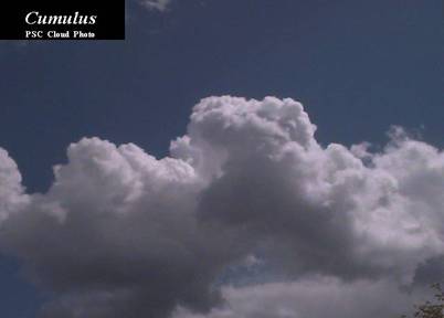
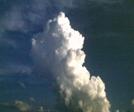
cumulus, stratus, and cirrus. As large areas of warm moist air
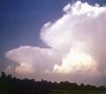
float upward and become puffy and fluffy, a cumulus cloud will form.
These clouds look like cotton balls and are usually found when there is good
weather present. Sometimes cumulus clouds can start to produce rain showers or
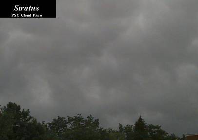
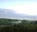
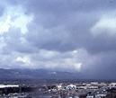
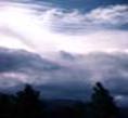
snow under the right temperature conditions. Stratus clouds are low dark
clouds that travel close to the Earth and do produce rain showers or snow.
These flat gray blanket looking clouds appear to cover the sky. They form a
flat layer of warm moist air that rises very slowly. This is a good time to
consider what a cloud needs to form. The height and the coolness of the air is
what help a cloud to form. Also, the formation of a cloud depends upon the
amount of water vapor that is present in the air. Some extra information about
cumulus clouds is that they show up in sunny skies at a bit higher level than
stratus clouds. Stratus clouds are low and often bring a drizzle to the Earth.
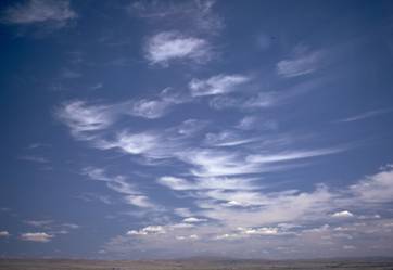
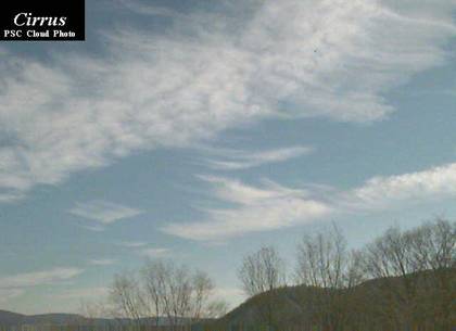
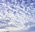
It is the third cloud family that is found high in the sky and looks light and
feathery. Some say that cirrus clouds appear to be like wisps high in
the sky. Sometimes they almost look like commas from a written page. Sometimes
cirrus clouds form when air rises high enough for ice crystals to form. This is
often a sign that rainy or snow weather is on its way.
|
THE TEN MOST COMMON CLOUDS |
||||
|
|
||||
|
cirrus |
cirrostratus |
cumulonimbus |
stratus |
nimbostratus |
|
|
|
|
|
|
|
stratocumulus |
cumulus |
altostratus |
altocumulus |
cirrocumulus |
|
|
|
|
|
|

These are very difficult
to say. It isn’t important that you remember all the cloud names. One thing you
should know is the cirrostratus clouds are high up in the sky, thin altostratus
clouds are at a mid-level in the sky, and the nimbostratus clouds are thick,
dark, and low in the sky. It is safe to say that without clouds anyone who
thinks the weather on any certain day was picture perfect without a cloud in
the sky is really incorrect. The water cycle could not exist without clouds. It
really is great that nature recycles the rain and the snow to keep the water
cycle moving!
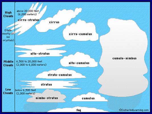
(above)
There are three main types of clouds.
They are cumulus, cirrus, and stratus.
Within these three types, there are sub-types of clouds. All together there are ten different types of
clouds that we can observe. Clouds
differ depending on their location in the sky, their color, and whether they
are flat or fluffy. This image helps classify the different types
of clouds. You can see the shape and
relative size of each cloud.
Storms are not something
that most people like because they are scary! Hurricanes are a type of
storm that is made up of wind and water. These spinning clouds bring strong
winds and very heavy rains. Most people think it is the wind in a hurricane
that causes the most damage. It is not. When a hurricane is building up its
wind it is also drawing up a lot of water. When the hurricane goes over the
land it takes its wind power with it but the water that has been soaked up
becomes a surge. A surge is what causes most of the damage during a hurricane.
When a hurricane starts out it is just a thunderstorm over the ocean. As it
soaks up heat and moisture from the warm ocean water, it turns into a
hurricane. They are also known as cyclones or typhoons. Hurricanes are the
largest type of storm on the Earth. A tornado is the result of a
thunderstorm also. A tornado’s air spins upward and can come out of nowhere.
The funnel shape in a tornado is the result of warm air beginning to spin. You
might be surprised to learn that the air pressure in a tornado is very low. It
is the outside winds that blow into the tornado’s low pressure that causes the
commotion. As these whirling funnels of air begin to form between the bottom of
a storm cloud and the ground, tornados might not go as far as hurricanes can
but can still cause a lot of damage. Hopefully you will never have to
experience either one of these storms but if you do be careful and listen to
the adults in charge. Have fun with the following questions. These past seven
units were about Earth systems. Now you move on in the next three units about
processes that shape the Earth.
CLOUD ACTIVITY:
Materials: cotton balls, lint from the clothes
dryer, poster board, paints, and glue
Try making your own cloud
display according to the shape of the three main cloud families. The three cloud families are cumulus,
stratus, and cirrus.
Your cotton balls will
make good fluffy puffy cumulus clouds. Your cirrus clouds can be pulled apart
and shaped into little commas. The grey dark dryer lint makes good stratus
clouds as you flatten them out to become low-lying blankets. You can paint your
sky blue for a background or color it. You will need to label the three main
cloud groups and show what kind of weather they bring to the Earth.

Below are additional educational resources and activities for this unit.